
|
What is GIS?
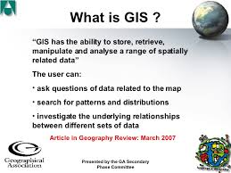
A popular exam question is 'What is GIS and how can it be used to.........?'What is GIS?
GIS (Geographic Information Systems) is one of the fastest growing software applications in the world. GIS is not one program and different types of GIS serve different purposes: a GIS that tracks and schedules freight on a route network is different from an environmental GIS. More than 80% of data collected can be linked to a location on the earth’s surface, so it is not surprising that GIS and mobile services are taking off. GIS really puts geography on the map! There are three elements to any GIS: a digital map, data located on the map, and a software application (GIS) that links the two together. A simple school GIS provides display and search facilities for mapped data. More sophisticated commercial GIS functions include spatial querying and analysis, buffering and spatial modelling. Trainees should be given the opportunity to explore ‘school’ and commercial GIS to decide which would be most suitable to incorporate into different lessons and to understand a progression in the use of GIS. |
National Curriculum Guidlinesdevelop and extend their competence in a range of skills including those used in fieldwork, in using maps and Geographical Information Systems (GIS) and in researching secondary evidence, including digital sources; and apply the cycle of collecting, presenting and analysing (geographical) data, including categorising and evaluating information and hypotheses (study like a geographer) apply geographical knowledge, understanding, skills and approaches appropriately and creatively to real world contexts, including fieldwork, and to contemporary situations and issues; and develop well-evidenced geographical argument drawing on their knowledge and understanding. (understand the application of geography) ut perspiciatis unde omnis iste natus error sit voluptatem accusant doloremque laudantium, totam rem.
|

Lesson Ideas |
